![](/images/other/stat-length.png)
![Randonnée V.T.T. Le Mage - La Croix Marion 17 km - Photo](https://media.geolcdn.com/t/1900/400/ext.pjpeg?maxdim=2&url=https%3A%2F%2Fstatic1.geolcdn.com%2Fsiteimages%2Fupload%2Ffiles%2F1524743154velo.jpg)
La Croix Marion 17 km
ODDAD78
Utilisateur
![Longueur](/images/other/stat-length.png)
![Altitude max](https://static1.geolcdn.com/siteimages/upload/files/1508320355ic_sort_altitude_max_24dp.png)
![Dénivelé positif](https://static1.geolcdn.com/siteimages/upload/files/1508320355ic_sort_den_pos_24dp.png)
![Km-Effort](/images/other/stat-length.png)
![Altitude min](https://static1.geolcdn.com/siteimages/upload/files/1508320355ic_sort_altitude_min_24dp.png)
![Dénivelé négatif](https://static1.geolcdn.com/siteimages/upload/files/1508320355ic_sort_den_neg_24dp.png)
![Boucle](https://static1.geolcdn.com/siteimages/upload/files/16400158638029165_repeat_loop_refresh_sync_direction_icon.png)
![V.T.T.](https://static1.geolcdn.com/sitytour/trail-icons/202.png)
1h25
Difficulté : Moyen
![Scannez ce code QR pour ouvrir la randonnée dans l'application SityTrail](https://capi.geolives.com/qq0zvz2zws4bq2lad0pu/sitytour/trails/4158187/qr.png?size=200)
Application GPS de randonnée GRATUITE
À propos
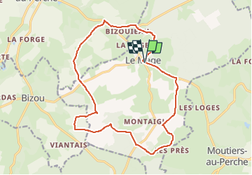
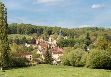
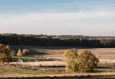
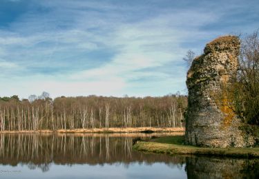
Randonnée V.T.T. de 16,9 km à découvrir à Normandie, Orne, Le Mage. Cette randonnée est proposée par ODDAD78.
Description
Pratique : À VTT
Durée : 4 h
Longueur : 16.9 km Dénivelé positif : 259 m Difficulté : Intermédiaire Type : Boucle
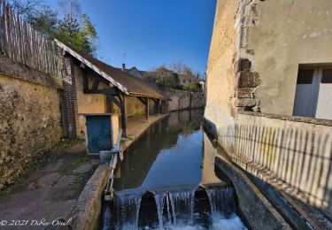
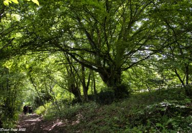
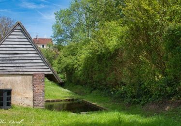
Thèmes : Découverte du bocage, Forêt, Panorama et paysages
Ce nouveau circuit VTT vous est proposé par la commune du Mage et par la communauté de communes des hauts du Perche, afin d'associer au plaisir du VTT une belle découverte de la campagne percheronne !
Départ : Le Mage Arrivée : Le Mage Balisage : VTT Communes : 1. Le Mage 2. Longny-au-Perche
3. Bizou
4. Moutiers-au-Perche
Localisation
Commentaires
Randonnées à proximité
![Randonnée Marche Longny les Villages - Longny-au-Perche La Brisardière 3,5 km - Photo](https://media.geolcdn.com/t/375/260/19108d03-3d8a-43b4-b05b-172408edde68.jpeg&format=jpg&maxdim=2)
![Marche Marche](https://static1.geolcdn.com/sitytour/trail-icons/101.png)
Marche
![](/images/other/stat-length.png)
![](https://static1.geolcdn.com/siteimages/upload/files/16400158638029165_repeat_loop_refresh_sync_direction_icon.png)
![Randonnée Marche Bizou - Bizou - Les sables du Perche 9,2 km - Photo](https://media.geolcdn.com/t/375/260/6b586e88-fad3-40df-be07-9b2a61186b9b.jpeg&format=jpg&maxdim=2)
![Marche Marche](https://static1.geolcdn.com/sitytour/trail-icons/101.png)
Marche
![](/images/other/stat-length.png)
![](https://static1.geolcdn.com/siteimages/upload/files/16400158638029165_repeat_loop_refresh_sync_direction_icon.png)
![Randonnée Marche Moutiers-au-Perche - Moutiers-au-Perche à Culoiseau 6,6 km - Photo](https://media.geolcdn.com/t/375/260/dd304cf5-1fa7-4625-9960-289d50411375.jpg&format=jpg&maxdim=2)
![Marche Marche](https://static1.geolcdn.com/sitytour/trail-icons/101.png)
Marche
![](/images/other/stat-length.png)
![](https://static1.geolcdn.com/siteimages/upload/files/16400158638029165_repeat_loop_refresh_sync_direction_icon.png)
![Randonnée A pied Moutiers-au-Perche - Perche authentique - Photo](https://media.geolcdn.com/t/375/260/1c5fa599-8a3f-4902-99d5-149fc7bd1ba4.jpeg&format=jpg&maxdim=2)
![A pied A pied](https://static1.geolcdn.com/sitytour/trail-icons/100.png)
A pied
![](/images/other/stat-length.png)
![](https://static1.geolcdn.com/siteimages/upload/files/16400158638029165_repeat_loop_refresh_sync_direction_icon.png)
![Randonnée Marche Le Mage - Le Mage - Longny-au-Perche (Longny les Villages) 11 km - Photo](https://media.geolcdn.com/t/375/260/7da85c06-6bc5-432c-afb8-5444ae0d01ad.jpg&format=jpg&maxdim=2)
![Marche Marche](https://static1.geolcdn.com/sitytour/trail-icons/101.png)
Marche
![](/images/other/stat-length.png)
![](https://static1.geolcdn.com/siteimages/upload/files/16400158638029165_repeat_loop_refresh_sync_direction_icon.png)
![Randonnée Marche Le Mage - Le Mage - Moutiers-au-Perche 9,2 km - Photo](https://media.geolcdn.com/t/375/260/2d6a74b1-d9ee-4f0d-9acb-9c00ceb2d8ab.jpg&format=jpg&maxdim=2)
![Marche Marche](https://static1.geolcdn.com/sitytour/trail-icons/101.png)
Marche
![](/images/other/stat-length.png)
![](https://static1.geolcdn.com/siteimages/upload/files/16400158638029165_repeat_loop_refresh_sync_direction_icon.png)
![Randonnée Marche Longny les Villages - Longny-au-Perche (Longny-les-Villages) - Moutiers-au-Perche 13 km - Photo](https://media.geolcdn.com/t/375/260/994a1e71-8c6d-4d56-88cb-a3f14cc14c65.jpg&format=jpg&maxdim=2)
![Marche Marche](https://static1.geolcdn.com/sitytour/trail-icons/101.png)
Marche
![](/images/other/stat-length.png)
![](https://static1.geolcdn.com/siteimages/upload/files/16400158638029165_repeat_loop_refresh_sync_direction_icon.png)
![Randonnée Marche Longny les Villages - Longny-au-Perche (Longny-les-Villages) - Tourouvre 22 km - Photo](https://media.geolcdn.com/t/375/260/f6a882c6-7265-4c4e-81b2-b739ea6f09f8.jpg&format=jpg&maxdim=2)
![Marche Marche](https://static1.geolcdn.com/sitytour/trail-icons/101.png)
Marche
![](/images/other/stat-length.png)
![](https://static1.geolcdn.com/siteimages/upload/files/16400158638029165_repeat_loop_refresh_sync_direction_icon.png)
![Randonnée Marche Bizou - Bizou 10.1 Km - Photo](https://media.geolcdn.com/t/375/260/4d9e3be8-2feb-4dcb-8c0c-693e0d367f80.jpeg&format=jpg&maxdim=2)
![Marche Marche](https://static1.geolcdn.com/sitytour/trail-icons/101.png)